Products
Categories:
- Featured Products, Charters, & Seminars
- Bait - Freshwater
- Bait - Saltwater
- Bait Bags - Paramount
- Bait Pumps
- Bait Tank Accessories
- Bait Tanks - Polyethylene
- Charts and Maps
- CLOTHING - Hats
- CLOTHING - Shirts
- CLOTHING - Sweatshirts
- Deck Hardware
- Hose and Hose Clamps
- Lubricants
- Plumbing Fittings
- Policy
- Pump Accessories
- Sealants
- Seminar Signup
Charts and Maps
|
Baja Directions Chart
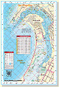
Newport Harbor
|
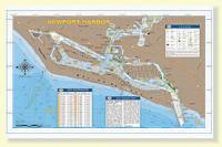
Our chart of Newport Harbor made its debut in our atlas and covers the entire lower Newport Bay, from the entrance between the jetties, to the channel leading into the Back Bay. This chart points out the main fish-holding features of the bay and even includes special fishing tips from the master of fishing Newport Bay, Mike Gardner. To fish with Mike call, (714) 671-0447 or email him at fishnohand@aol.com.
|
$14.99 |
|
Baja Directions Chart
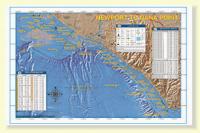
Newport to Dana Point
|
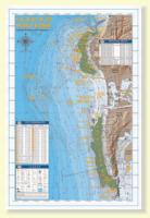
Our Newport to Dana chart covers the Orange County coast from Huntington Beach down to Doheny Beach on the south side of Dana Point. This chart covers spots like Izor’s Reef, the 108 Area and the Santa Ana River Pipe areas on the east side of the Long Beach Shelf, all the way south through the myriad spots along the cliffs of Laguna. The chart’s southern end terminates at the entrance to Dana Point Harbor, but not before showing the locations of such fine fishing spots as Pelican Point Reef, the Blue Roof Area, the Laguna Pinnacles, 1000 Steps Kelp, the 100 Fathom Curve off the Hospital in South Laguna and the Monarch Boilers.
|
$14.99 |
|
Baja Directions Chart
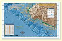
Palos Verdes With MLPA Closures
|
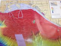
Our detailed chart of the Palos Verdes Peninsula covers the entire peninsula, from its northern beginnings at Malaga Cove to its abrupt end at Cabrillo Beach, the west end of the Long Beach Breakwater. Included are the Bay Junk and Seabass Rock areas of Rocky Point, as well as such storied areas as the Pinnacles, the Barber Shop, Marineland Reef and Pt. Fermin Reef
|
$14.99 |
|
Baja Directions Chart
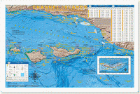
Channel Islands
|
This chart focuses on the inshore and offshore fishing areas of the Santa Barbara Channel, accessible from Oxnard, Ventura and Santa Barbara harbors. Included are San Miguel, Santa Rosa, Santa Cruz and Anacapa Islands, as well as legendary hotspots like 12-Mile Reef, Horseshoe Reef, Arco Island, Footprint Reef, Hidden Reef and the Santa Rosa Flats. This chart contains valuable information for the private boater such as clearly marked MPA areas, fishing hotspots with GPS coordinates, anchorages, navigation waypoints, headings to and from major Island features and mainland Harbors, as well as expert tips, tactics and techniques by species. This high-resolution 3-D rendered map is available in the popular waterproof and tear-resistant, folded version or in the best-selling flat laminate format.
|
$11.99 |
|
Baja Directions Chart
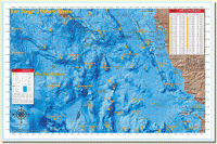
San Diego Offshore
|
This chart covers the offshore fishing areas from the southern half of San Clemente Island, south to the fabled “Inner Banks†area off Ensenada. The chart now includes water as far west as the Cortes and Tanner Banks, as well as areas like the Upper 500, 483/500 and the Knuckle which have been especially hot in recent years. Valuable information for the private boater such as clearly marked fishing hotspots with GPS coordinates and compass headings to and from all major harbors, expert tips and techniques by species and a fish identification chart that includes information on how to properly identify each featured species are included. This high-resolution 3-D rendered map is available in the popular waterproof and tear-resistant, folded version or in the best-selling flat laminate format. Backside Frontside Laminate 11 X 17 or 16 X 24 Folded 16 X 24
|
$14.99 |
|
Fish-n-Map Chart
San Diego-Ensenada Outer Banks, plus Coronado Islands
|
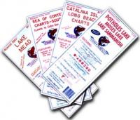
Fish-n-Map Underwater Topography Maps- printed on a water-proof, tear-resistant plastic material for durability and are folded to 9"x4". When opened, each map is approximately 3'x2' in size. Most maps are printed on both sides.
Our maps include extensive and detailed legends that guide you through valuable information such as Lake Size & Elevation Known Fish Species Underwater Bottom Conditions Depth Contours Boat Ramp Locations River Inlets, Feeder Creeks & Canals Submerged Brush & Rock Reefs Longitude & Latitude Campgrounds & Restrooms Lodging, Groceries & Fuel RV Hook-ups, Showers & Lodging Suggested Fishing Locations |
$10.99 |
|
Fish-n-Map Chart
Pacific Coast Charts (Pt. Arguello to Mexico) |
Fish-n-Map Underwater Topography Maps- printed on a water-proof, tear-resistant plastic material for durability and are folded to 9"x4". When opened, each map is approximately 3'x2' in size. Most maps are printed on both sides.
Our maps include extensive and detailed legends that guide you through valuable information such as Lake Size & Elevation Known Fish Species Underwater Bottom Conditions Depth Contours Boat Ramp Locations River Inlets, Feeder Creeks & Canals Submerged Brush & Rock Reefs Longitude & Latitude Campgrounds & Restrooms Lodging, Groceries & Fuel RV Hook-ups, Showers & Lodging Suggested Fishing Locations |
$10.99 |
|
Fish-n-Map Chart
Catalina Is.- Long Beach Chart |
Fish-n-Map Underwater Topography Maps- printed on a water-proof, tear-resistant plastic material for durability and are folded to 9"x4". When opened, each map is approximately 3'x2' in size. Most maps are printed on both sides.
Our maps include extensive and detailed legends that guide you through valuable information such as Lake Size & Elevation Known Fish Species Underwater Bottom Conditions Depth Contours Boat Ramp Locations River Inlets, Feeder Creeks & Canals Submerged Brush & Rock Reefs Longitude & Latitude Campgrounds & Restrooms Lodging, Groceries & Fuel RV Hook-ups, Showers & Lodging Suggested Fishing Locations |
$11.99 |
|
Fish-n-Map Chart
Baja California North (Pacific Side) |
Fish-n-Map Underwater Topography Maps- printed on a water-proof, tear-resistant plastic material for durability and are folded to 9"x4". When opened, each map is approximately 3'x2' in size. Most maps are printed on both sides.
Our maps include extensive and detailed legends that guide you through valuable information such as Lake Size & Elevation Known Fish Species Underwater Bottom Conditions Depth Contours Boat Ramp Locations River Inlets, Feeder Creeks & Canals Submerged Brush & Rock Reefs Longitude & Latitude Campgrounds & Restrooms Lodging, Groceries & Fuel RV Hook-ups, Showers & Lodging Suggested Fishing Locations |
$10.99 |
|
Fish-n-Map Chart
LA & Orange Co. Inshore Chart |
Fish-n-Map Underwater Topography Maps- printed on a water-proof, tear-resistant plastic material for durability and are folded to 9"x4". When opened, each map is approximately 3'x2' in size. Most maps are printed on both sides.
Our maps include extensive and detailed legends that guide you through valuable information such as Lake Size & Elevation Known Fish Species Underwater Bottom Conditions Depth Contours Boat Ramp Locations River Inlets, Feeder Creeks & Canals Submerged Brush & Rock Reefs Longitude & Latitude Campgrounds & Restrooms Lodging, Groceries & Fuel RV Hook-ups, Showers & Lodging Suggested Fishing Locations |
$11.99 |
|
Fish-n-Map Chart
San Diego - Oceanside |
Fish-n-Map Underwater Topography Maps- printed on a water-proof, tear-resistant plastic material for durability and are folded to 9"x4". When opened, each map is approximately 3'x2' in size. Most maps are printed on both sides.
Our maps include extensive and detailed legends that guide you through valuable information such as Lake Size & Elevation Known Fish Species Underwater Bottom Conditions Depth Contours Boat Ramp Locations River Inlets, Feeder Creeks & Canals Submerged Brush & Rock Reefs Longitude & Latitude Campgrounds & Restrooms Lodging, Groceries & Fuel RV Hook-ups, Showers & Lodging Suggested Fishing Locations |
$10.99 |
|
Fish-n-Map Chart
Diamond Valley - Irvine Lake - Puddingstone Res |
Fish-n-Map Underwater Topography Maps- printed on a water-proof, tear-resistant plastic material for durability and are folded to 9"x4". When opened, each map is approximately 3'x2' in size. Most maps are printed on both sides.
Our maps include extensive and detailed legends that guide you through valuable information such as Lake Size & Elevation Known Fish Species Underwater Bottom Conditions Depth Contours Boat Ramp Locations River Inlets, Feeder Creeks & Canals Submerged Brush & Rock Reefs Longitude & Latitude Campgrounds & Restrooms Lodging, Groceries & Fuel RV Hook-ups, Showers & Lodging Suggested Fishing Locations |
$10.99 |
|
Baja Directions Chart
Mag Bay
|
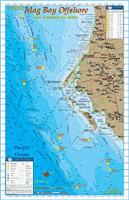
The one chart that never lived up to our expectations due to the truly incredible offshore fishing available in the region for trophy size tuna, wahoo and marlin was our “Mag Bay†chart. We had quite a few sugestions about our Mag Bay fishing chart ever since it was conceived in 1999 and we listened by not only updating the title, but completely redoing it! We resized the chart, gave it a face-lift with our newly acquired underwater contours (bathymetry) and “3-D†land topography from our Mexican government sources and changed the name to the more appropriate “Mag Bay Offshore.†The result is one of the most breathtaking charts in our line-up! The new bathymetry is nothing short of spectacular; in fact this chart may easily be the most detailed view of the ocean floor ever produced for the waters in the Bahia Magdalena region. Also, the 100, 500 and 1000 fathom curves are highlighted so you can easily find blue “offshore†water while chasing those pelagic species. Included are the locations and GPS coordinates of the 23 Spot and Pistol (a.k.a. The 38) spots on The Ridge, but also names of areas well-known by offshore fisherman from all over the world like Thetis Bank, Petrel Bank, Potato Bank, Morgan Bank and much more! The back side of the chart has a large scale map of the inner waters of Bahia Magdalena proper and also contains a great deal of information such as GPS coordinates and a seasonal fishing calendar. This full color, high-resolution chart is currently available exclusively in our popular 11â€x17†laminated format.
|
$14.99 |
|
Baja Directions Chart
Ensenada
|
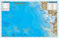
Newly resized from our old title, our Ensenada chart covers the fishing areas from the kelp beds of La Fonda located just north of Puerto La Salina, to Punta San Jose to the south, a good hour’s run down the coast from Ensenada. This chart features GPS numbers and locations of both offshore and inshore fishing areas such as the Hidden Bank, Upper 500 Fathom Spot, Banda Bank, Bajo San Miguel and the Double 220 Fathom Spot, as well as lesser known areas such as El Isolote and White Rock - small rocky islets jutting from the ocean’s surface off Punta Santo Tomas and Punta Banda respectively. The underwater contours (bathymetry) of this chart were rendered from a private survey for natural gas and oil exploration and remain the absolute most detailed view of the ocean floor off Ensenada in existence! Also featured is a separate large-scale chart of Bahia Todos Santos that details out the harbor areas of Ensenada, including the popular Hotel Coral & Marina. This full color, high-resolution chart also features a seasonal fishing calendar which lists the best months for fishing by species and is currently available exclusively in our popular 11â€x17†laminated format.
|
$14.99 |
|
Baja Directions Chart
Santa Monica Bay
|
Making its debut in the atlas, our Santa Monica Bay chart covers the Malibu coast from the west side of Point Dume, all the way around the bay to the head of the Redondo Canyon. Legendary spots like the Big Kelp Reef (BKR), Twin Towers, El Segundo Pipe and Short Banks are covered, as well as lesser-known areas such as the Corral Beach Reef, Big Rock and the hard bottom off Manhattan Beach.
|
$14.99 |
|
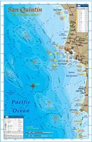
Baja Directions Chart
San Quintin
|
We made quite a few changes from our original San Quintin title by shifting the focus of our chart to a larger scale and including the great fishing areas a full day boat ride to the south of San Quintin. This chart encompasses the Baja coast from Punta Camalu to the north and Sacramento Reef to the south, including Isla Jeronimo, Punta Baja and Isla San Martin. The GPS numbers of prime bottom fishing areas like Ben’s Rock, Breakers Reef (a.k.a. The 240), and the 61/2 Fathom Spot are featured on the chart, as well as the white sea bass areas of increasing fame such as Pabellon Beach, El Tranquilo and Socorro. Also included is a satellite image of Bahia San Quintin taken on an extraordinarily clear water day which distinctly shows the infamous channel in and out of the bay. We have also acquired GPS numbers marking the channel from a gentleman who has 30 years experience navigating through the bay! The positions of these GPS waypoints have been precisely overlayed on top of the satellite photo, giving you a frame of reference as to where in the channel each waypoint is. Baja Directions, Inc. still recommends hiring a local guide to get you safely in and out of the bay at least the first few times, but this incredible resource is a must-have for the experienced and first-timer alike as it will definitely shorten your learning curve. The locations of the most popular facilities in the San Quintin area such as the Old Mill, Don Eddies, Campo de Lorenzo sky park and more are also pointed out on the satellite image, making this chart a one-stop resource for the traveling fisherman. This full color, high-resolution map is also available exclusively in our popular 11â€x17†laminated format.
|
$14.99 |
|
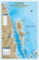
Baja Directions Chart
Bay of Los Angeles (Bahia de Los Angeles)
|
We had many suggestions for our old LA Bay chart and we listened by not only updating the title, but completely redoing the chart itself. First off, we eliminated the north half of the old chart and changed the name from “San Felipe/LA Bay†to the more appropriate “LA Bay Including the Upper Midriff Islands.†The result is a much larger scale chart, which focuses on exactly the area that fishermen can cover on a long day’s boat ride out of the popular Baja fishing destination of Bahia de Los Angeles (commonly referred to as LA Bay). This chart covers from Punta Final to the north, south to Bahia San Francisquito and includes the northern islands of the Sea of Cortez’s Midriff Island region such as Isla Angel de la Guarda, Isla Partida, Isla Rasa, Isla Salsipuedes, Isla Animas, Isla Esteban and many more. The locations of 17 popular fishing areas such as Isla Estanque (Snake Island), Isla Smith, Los Candeleros and Bajo Guadalupe are shown precisely on the map along with their corresponding GPS coordinates. Also our laminated version features a seasonal fishing calendar, and a large-scale map of Bahia de los Angeles which shows many of the popular fishing spots and underwater contours of the Bahia itself, along with the facilities at LA Bay for boat launching, camping, lodging and more!This full color, high-resolution chart is currently available exclusively in our popular 11â€x17†laminated format.
|
$14.99 |
|
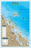
Baja Directions Chart
Mulege
|
Revamped in 2008 with official data from the government of Mexico, our fishing chart of the sleepy sportfishing destination of Mulege covers the fishing areas accessible from Santa Roaslia, including Isla Tortuga and Isla San Marcos, south to Punta Santa Teresa - located some 30 miles down the coast from Punta Chivato. This chart in fact ends up overlapping our Loreto chart at Bahia San Nicolas. The title “Mulege†is definitely a misnomer however, as much effort has been given to incorporate fishing information for areas directly accessible from Santa Rosalia, San Lucas Cove, Punta Chivato and Bahia Concepcion, as well as from Mulege. Our Mulege chart features updated underwater contours (bathymetry), “3-D†land, road and facilities information along with popular inshore and offshore fishing areas such as the 110 Bajo off the north tip of Isla San Marcos, the Haystack just north of San Lucas Cove and the fabled Punta Azul Curve at Isla Tortuga. On the laminated version the backside of the chart has large-scale individual charts of Isla San Marcos, Punta Chivato and Bahia Concepcion, as well as a seasonal fishing calendar. This full color, high-resolution chart is currently available exclusively in our popular 11â€x17†laminated format.
|
$14.99 |
|
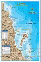
Baja Directions Chart
Loreto
|
Revamped in 2008 with official data from the government of Mexico, our fishing chart of the popular sportfishing destination of Loreto covers the fishing areas from 5 miles north of Isla San Ildefosnso to Punta San Marcial, including the waters off Loreto, Puerto Escondido, and water surroundung Isla El Carmen and Isla Monserrate. This chart features updated underwater contours (bathymetry), “3-D†land, road and facilities information along with popular fishing areas such as Roca Blanco, Punta El Pulpito and the fabled 100 fathom curve off Punta Cholla. The back side of the chart contains a great deal of information such as explanations on how to fish each highlighted area, GPS coordinates, a seasonal fishing calendar, fish identification chart, and much more. This full color, high-resolution map is currently available exclusively in our popular 11â€x17†laminated format.
|
$14.99 |
|
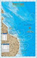
Baja Directions chart
East Cape
|
Revamped in 2008 with official data from the government of Mexico, our chart of the East Cape region of Baja California between Cabo San Lucas and La Paz is one of our favorites. The area covered by our East Cape title overlaps both our La Paz and Cabo San Lucas fishing map titles; from the southern tip of Isla Cerralvo to just north of Punta Gorda, including the waters off Punta Pescadero, Los Barrilles, Punta Colorada, Cabo Pulmo and Los Frailes. Fishing areas shown in the East Cape region include Pescadero (a.k.a. “Tunaâ€) Canyon, Vinorama Beach and Los Frailes Canyon. The underwater contours we acquired from the Mexican government are nothing short of spectacular, in fact this chart may easily be the most detailed view of the ocean floor ever produced for the waters off the East Cape region. Also, the 100, 500 and 1000 fathom curves are highlighted so you can easily find the “blue water†while chasing those pelagic species offshore. This chart also shows the locations of all the hotels on the East Cape, making this chart a must-have for the shore angler so he can stay on the bite. The back side of the chart contains a great deal of information such as explanations on how to fish each highlighted area, GPS coordinates, a seasonal fishing calendar, fish identification chart, and much more. This full color, high-resolution chart is currently available exclusively in our popular 11â€x17†laminated format.
|
$14.99 |
|
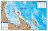
Baja Directions Chart
La Paz
|
Newly redesigned for 2008, our La Paz chart covers the fishing areas from Punta Coyote to just South of the Isla Cerralvo, including Bahia de La Paz, and the waters off Isla Espiritu Santo, Isla La Partida, and Isla Cerralvo. This chart features updated underwater contours (bathymetry), “3-D†land, updated road and facilities information along with popular fishing areas such as: El Bajo, El Charro Seamount, 88 Bank (a.k.a. Ocho-Ocho), Bajo San Lorenzo and Punta Arena. Also, the 100 and 500 Fathom Curves are highlighted so you can easily find the offshore “bluewater†and stay on those pelagic game fish. The back side of the chart contains a great deal of information such as explanations on how to fish each highlighted area, GPS coordinates, a seasonal fishing calendar, fish identification chart, and much more. This full color, high-resolution chart is currently available exclusively in our popular 11â€x17†laminated format.
|
$14.99 |
|
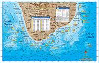
Baja Directions Chart
Cabo San Lucas
|
Known by many as the “Sportfishing Capital of the World,†Cabo San Lucas at the tip of Baja California surely is an angling paradise. Warm offshore currents from the Sea of Cortez converge here with the cooler waters of the deep blue Pacific Ocean and cause massive temperature breaks that attract a veritable smorgasbord of baitfish for pelagic species such as yellowfin tuna, dorado and wahoo, as well as striped, blue and black marlin. Our Cabo San Lucas fishing chart has been a best seller for years, but in 2008 we obtained new underwater contour (bathymetry) data from our Mexican government sources and we absolutely had to update this title. The underwater contours we acquired are absolutely stunning and much more detailed than we ever could imagine. The bottom depth variations are amazing to see as the contours of the ocean floor are shown in stark detail on the chart, in fact this map may easily be the most detailed view of the ocean floor ever produced for the waters off the tip of Baja California! Also, the 100, 500 and 1000 fathom curves are highlighted so you can easily find blue “offshore†water while chasing those pelagic species. Our Cabo San Lucas map reveals such legendary fishing areas as the Gorda Banks, Golden Gate Bank, Vinorama Canyon, the 1150 Bank, Iman Bank, Cabrillo Bank and much more. The chart extent covers from Bahia Los Frailes on the Cortez side and wraps around the Baja Peninsula to the Pacific terminating at Punta Pescadero, just south of the beachside community of Todos Santos. The back side of the chart contains a great deal of information such as explanations on how to fish each highlighted area, GPS coordinates, a seasonal fishing calendar, fish identification chart, and much more. This full color, high-resolution map is currently available exclusively in our popular 11â€x17†laminated format.
|
$14.99 |
|
Sportfishing Atlas
Baja California Edition
|
Years of research and thousands of hours in the making, the latest Baja Directions product, the Sportfishing Atlas Baja California Edition offers perhaps the most comprehensive look ever of the productive waters of Baja California, a region world-renowned for fantastic sport fishing. This atlas is a must-have for every Baja enthusiast. While cruising on the coast, trailering to remote locations or simply flying down and chartering a Sportfishing boat, the Baja California Edition atlas contains the type of detailed information that will enhance the experience for any sportsman. The original 9 chart titles that the company debuted in 1999 cover the region’s most popular Sportfishing destinations like Cabo San Lucas, the East Cape, La Paz and Loreto. The atlas not only features these original 9 charts in one product, but also contains 4 small-scale overview maps that combined cover every square inch of the Baja Peninsula, as well as 3 new large-scale chart titles that cover the areas most requested over the years by Baja Directions’ customers. Every Baja enthusiast knows that information about the region is hard to come by. Road maps show vaguely what road conditions are like and where they go. Ocean maps of the region are dated and lack much detail of the ocean floor other than a handful of sparsely grouped depth soundings. Not only does Baja Directions Sportfishing Atlas Baja California Edition better both counts with detailed road information and the most detailed bathymetric maps ever made of Baja waters, but it also includes 100’s of GPS waypoints of the top fishing spots, prominent landmarks and harbors on both coasts, locations of important facilities like gas stations, marinas, fuel docks, boat ramps and more. Put simply, the Sportfishing Atlas Baja California Edition packs an incredible amount of hard-to-find information into on simple and easy to use product.
|
$49.99 |
|
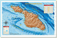
Baja Directions Chart
Santa Catalina and San Clemente Islands
|
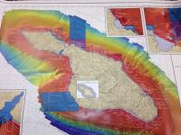
This chart covers the fishing areas around Santa Catalina and San Clemente Islands, including perennial inshore hotspots such as The Vee’s, Orange Rocks, Italian Gardens and East End Light, as well as offshore spots such as Farnsworth and Mackerel Banks. The chart contains valuable information for the private boater such as clearly marked fishing hotspots with GPS coordinates and local names, locations of boiler rocks and kelp, expert tips and techniques by species, compass headings to and from the islands and mainland harbors, and a fish identification chart that includes information on how to properly identify each featured species. This high-resolution 3-D rendered map is available in the popular waterproof and tear-resistant folded version or in the best-selling flat laminate format. Detailed charts of both Catalina and San Clemente Islands are included here.
|
$14.99 |
|
Baja Directions Chart
San Diego Bay & Mission Bay
|
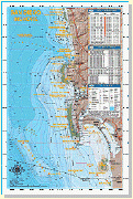
Formerly sold independently, maps of San Diego Bay and Mission Bay have been combined into one product. This map covers both San Diego and Mission Bays in great detail and provides valuable information from experts like Barry Brightenburg, owner of Fish Trap Lures, on the best spots to fish, when to fish them, and how to fish them. Fish-holding areas like eelgrass beds, clam beds, submerged cable, underwater jetties and platforms are highlighted on the chart, as well as important boating information like Security Zones around Naval facilities and the locations of fuel docks and marinas in both Harbors. An added feature of this updated chart is a series of navigation waypoints lining the Main Channel that aid in nighttime navigation, both departing and returning to San Diego Bay. In addition, there is important information pertaining to boater safety and fish identification. This high-resolution shaded relief map is available in the popular waterproof and tear-resistant, folded version or in the best-selling flat laminate format.
|
$14.99 |
|
Baja Directions Chart
La Jolla/Point Loma
|
Our La Jolla to Point Loma chart is sure to be a hit with local anglers and visiting anglers alike. This chart covers the La Jolla Kelp and Point Loma Kelp areas in detail never seen before. Spots like The 32, The Airplane, Variety Kelp, Jetty Kelp and The Pine Tree are sure to intrigue veteran fisherman, while newcomers will benefit from the locations of such perennial hotspots like Northwest Corner, the Green Tank and the DO.
|
$14.99 |
|
Baja Directions Charts
San Diego Inshore
|
This chart covers the inshore fishing areas from Cardiff in north San Diego County to “The Bullringâ€, just south of the Mexican border. Inshore anglers focusing on detailed bottom features will appreciate the larger scale of the updated version of this chart. Coverage is from the shoreline out to eleven miles offshore and features such talked-about fishing spots as the Nortwest Corner and Variety Kelp areas of the La Jolla Kelp, the Green Tanks and DO areas of Point Loma Kelp and also the Imperial Beach Pipe. The chart contains valuable information for the private boater such as clearly marked fishing hotspots with GPS coordinates, expert tips, tactics and techniques by species, locations of launch ramps, jetties, artificial reefs and buoys, plus our new bottom composition and kelp data acquired from Scripps Institute! This high-resolution 3-D rendered map is available in the popular waterproof and tear-resistant, folded version or in the best-selling flat laminate format.
|
$14.99 |
|
Baja Directions Chart
Dana Point to Oceanside
|
Our Dana Point to Oceanside chart that covers the fabled Salt Creek area in southern Laguna, down the coast to Cardiff-by-the-Sea in northern San Diego County. Locals will recognize spots like the Barber Poles, Box Canyon, Patterson Kelp, Anderson Pipe and Swami’s reef, while the visiting angler will be happy to see such renowned spots as the The Domes, the Barn Kelp and Clambeds.
|
$14.99 |
|
Baja Directions Chart
LA/OC Offshore Banks
|
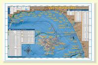
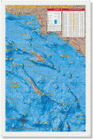
This chart covers the offshore fishing areas from Marina del Rey to Dana Point and includes the Santa Barbara, Santa Catalina and San Clemente Islands. This popular chart now includes water as far south as The Butterfly and as far west as the Cortes and Tanner Banks, as well as added hotspots like the Boot Bank, The Snail and 499 Spot. The chart contains valuable information for the private boater such as clearly marked fishing hotspots with GPS coordinates and compass headings to and from all major harbors, expert tips and techniques by species and a fish identification chart that includes information on how to properly identify each featured species. This high-resolution 3-D rendered map is available in the popular waterproof and tear-resistant, folded version or in the best-selling flat laminate format.
|
$14.99 |
|
Baja Directions Chart
Long Beach Shelf
|
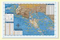
Our Long Beach Shelf chart covers the Palos Verdes Peninsula to The Cliffs area of Huntington Beach. Included are the Rocky Point, Marineland and Royal Palms areas of Palos Verdes, as well as the entire Horseshoe Kelp and nearby 150 Area of the Long Beach Shelf. Izor’s Reef, the 108 Area and the ¼-Acre Spot and Bubbles areas of the Huntington Flats are also covered in detail.
|
$14.99 |
